
Pantai Porok topographic map
Interactive map
Click on the map to display elevation.
About this map
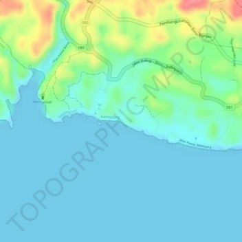
Name: Pantai Porok topographic map, elevation, terrain.
Average elevation: 20 m
Minimum elevation: 0 m
Maximum elevation: 86 m
Other topographic maps
Click on a map to view its topography, its elevation and its terrain.
Sepanjang Beach
Indonesia > Special Region of Yogyakarta > Gunung Kidul Regency > Kemadang
Sepanjang Beach, Kemadang, Tanjungsari, Gunung Kidul Regency, Special Region of Yogyakarta, Java, Indonesia
Average elevation: 15 m