
Thank you for supporting this site ❤️
Make a donation
Make a donation
Gear up for your next adventure:
As an Amazon Associate, this site earns from qualifying purchases at no extra cost to you.
Valmuel topographic map
Click on the map to display elevation.
Thank you for supporting this site ❤️
Make a donation
Make a donation
Gear up for your next adventure:
As an Amazon Associate, this site earns from qualifying purchases at no extra cost to you.
About this map
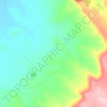
Name: Valmuel topographic map, elevation, terrain.
Location: Valmuel, Alcañiz, Bajo Aragón, Teruel, Aragonien, Spanien (41.11340 -0.18828 41.13340 -0.16828)
Average elevation: 326 m
Minimum elevation: 248 m
Maximum elevation: 489 m
Thank you for supporting this site ❤️
Make a donation
Make a donation
Gear up for your next adventure:
As an Amazon Associate, this site earns from qualifying purchases at no extra cost to you.