
Thank you for supporting this site ❤️
Make a donation
Make a donation
Gear up for your next adventure:
As an Amazon Associate, this site earns from qualifying purchases at no extra cost to you.
Marra topographic map
Click on the map to display elevation.
Thank you for supporting this site ❤️
Make a donation
Make a donation
Gear up for your next adventure:
As an Amazon Associate, this site earns from qualifying purchases at no extra cost to you.
About this map
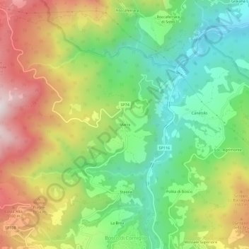
Name: Marra topographic map, elevation, terrain.
Location: Marra, Corniglio, Parma, Emilia-Romagna, 43021, Italien (44.44430 10.01562 44.48430 10.05562)
Average elevation: 902 m
Minimum elevation: 591 m
Maximum elevation: 1,341 m
Thank you for supporting this site ❤️
Make a donation
Make a donation
Gear up for your next adventure:
As an Amazon Associate, this site earns from qualifying purchases at no extra cost to you.