
Thank you for supporting this site ❤️
Make a donation
Make a donation
Gear up for your next adventure:
As an Amazon Associate, this site earns from qualifying purchases at no extra cost to you.
Tiefenbachklamm topographic map
Click on the map to display elevation.
Thank you for supporting this site ❤️
Make a donation
Make a donation
Gear up for your next adventure:
As an Amazon Associate, this site earns from qualifying purchases at no extra cost to you.
About this map
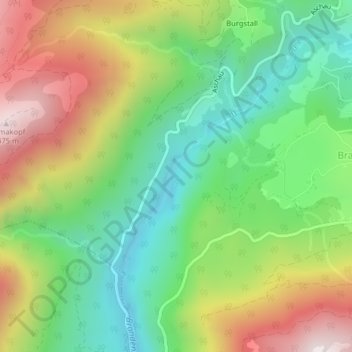
Name: Tiefenbachklamm topographic map, elevation, terrain.
Location: Tiefenbachklamm, Brandenberg, Bezirk Kufstein, 6234, Austria (47.47854 11.86207 47.49854 11.88207)
Average elevation: 941 m
Minimum elevation: 571 m
Maximum elevation: 1,488 m
Thank you for supporting this site ❤️
Make a donation
Make a donation
Gear up for your next adventure:
As an Amazon Associate, this site earns from qualifying purchases at no extra cost to you.