Geolocate

Nongjrong topographic map

Click on the map to display elevation.

About this map

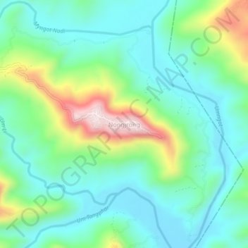
Name: Nongjrong topographic map, elevation, terrain.

Location: Nongjrong, Mawkynrew, East Khasi Hills, Meghalaya, India (25.45891 92.07029 25.49891 92.11029)

Average elevation: 1,176 m

Minimum elevation: 1,049 m

Maximum elevation: 1,516 m

Gear up for your next adventure:

🧼Biodegradable Camp Soap - Environmentally friendly cleaning for gear and body
🧭Orienteering Kit - Tools for map reading and navigation in the wild
🧥Softshell Hiking Jacket - The perfect balance of wind protection and breathability
🥾Hiking Gaiters - Protect legs and shoes from mud, snow, and debris
🧢Outdoor Visor - Breathable visor for sunny hikes

As an Amazon Associate, this site earns from qualifying purchases at no extra cost to you.