Geolocate

Big Foot Colonia topographic map

Click on the map to display elevation.

About this map

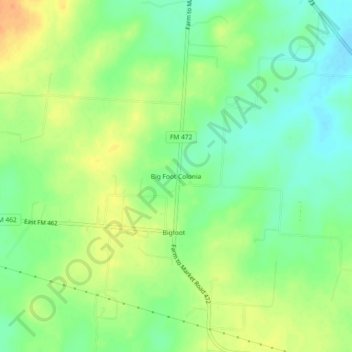
Name: Big Foot Colonia topographic map, elevation, terrain.

Location: Big Foot Colonia, Frio County, Texas, 78005, United States (29.03330 -98.88642 29.07330 -98.84642)

Average elevation: 197 m

Minimum elevation: 180 m

Maximum elevation: 217 m

Gear up for your next adventure:

Camping Tent - Weather-resistant tents suitable for 2 to 6 people
🔦LED Flashlight - Powerful and long-lasting flashlight for camping and emergencies
❄️Traction Ice Cleats - Slip-on spikes for icy trails and winter hiking
🥾Lightweight Hiking Boots - Boots for comfort and mobility on long hikes
🚲MTB Frame Bag - Carry tools and maps directly on your bicycle frame

As an Amazon Associate, this site earns from qualifying purchases at no extra cost to you.