Geolocate

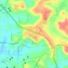
Mukka topographic map

Click on the map to display elevation.

About this map

Name: Mukka topographic map, elevation, terrain.

Location: Mukka, Mangaluru taluk, Dakshina Kannada, Karnataka, 575021, India (13.00244 74.77000 13.04244 74.81000)

Average elevation: 7 m

Minimum elevation: -3 m

Maximum elevation: 34 m

Other topographic maps

Click on a map to view its topography, its elevation and its terrain.
Jeppu Park

India > Karnataka > Mangaluru taluk > Mangaluru

Average elevation: 13 m

Kadri Park

India > Karnataka > Mangaluru taluk > Mangaluru

Average elevation: 44 m

Jeppu Park

India > Karnataka > Mangaluru taluk > Mangaluru

Average elevation: 13 m

Gear up for your next adventure:

🌬️Windproof Camp Stove - Efficient cooking even on exposed mountain peaks
🧊Insulated Water Bottle - Keeps drinks cold in summer and prevents freezing in winter
🎒Hiking Backpack - Lightweight and ergonomic backpacks for day hikes or multi-day treks
⛺Camping Tent - Weather-resistant tents suitable for 2 to 6 people
🥤Collapsible Travel Cup - Saves space and weight in your mess kit

As an Amazon Associate, this site earns from qualifying purchases at no extra cost to you.