Geolocate

Waitārere topographic map

Click on the map to display elevation.

About this map

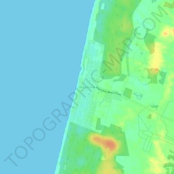
Name: Waitārere topographic map, elevation, terrain.

Location: Waitārere, Horowhenua District, Manawatū-Whanganui, New Zealand (-40.57069 175.17782 -40.53069 175.21782)

Average elevation: 8 m

Minimum elevation: 0 m

Maximum elevation: 34 m

Other topographic maps

Click on a map to view its topography, its elevation and its terrain.

Gear up for your next adventure:

🛌Insulated Sleeping Pad - Critical thermal barrier between you and the cold ground
💡LED Camping Lantern - Illuminate your campsite with long-lasting lanterns
🕶️Polarized Sunglasses - Protect your eyes with durable polarized lenses
🧦Hiking Socks - Moisture-wicking and comfortable socks for long hikes
🕶️Polarized Sunglasses - Reduces glare from snow and water at high elevations

As an Amazon Associate, this site earns from qualifying purchases at no extra cost to you.