Geolocate

Kalynove topographic map

Click on the map to display elevation.

About this map

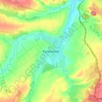
Name: Kalynove topographic map, elevation, terrain.

Location: Kalynove, Алчевський район, Luhansk Oblast, 93350, Ukraine (48.52198 38.46811 48.60866 38.54982)

Average elevation: 143 m

Minimum elevation: 92 m

Maximum elevation: 235 m

Other topographic maps

Click on a map to view its topography, its elevation and its terrain.

Makiivka

Ukraine > Luhansk Oblast

Average elevation: 113 m

Troitske

Ukraine > Luhansk Oblast

Average elevation: 146 m

Ivanivka

Ukraine > Luhansk Oblast > Antratsyt Raion

Average elevation: 325 m

Raihorodka

Ukraine > Luhansk Oblast

Average elevation: 59 m

Topolivka

Ukraine > Luhansk Oblast

Average elevation: 180 m

16

Ukraine > Luhansk Oblast > Luhansk

Average elevation: 114 m

Duvanka

Ukraine > Luhansk Oblast

Average elevation: 120 m

Novodarivka

Ukraine > Luhansk Oblast

Average elevation: 292 m

Pavlivka

Ukraine > Luhansk Oblast

Average elevation: 198 m

Uspenka

Ukraine > Luhansk Oblast > Lutuhyne Raion

Average elevation: 123 m

Miusynsk

Ukraine > Luhansk Oblast > Miusynsk

Average elevation: 154 m

Lysychansk

Ukraine > Luhansk Oblast > Lysychansk

Average elevation: 115 m

Lisna Dacha

Ukraine > Luhansk Oblast > Lisna Dacha

Average elevation: 59 m

Ploshchanka

Ukraine > Luhansk Oblast

Average elevation: 154 m

Gear up for your next adventure:

👟Leg Gaiters - Keep debris, mud, and snow out of your boots
🥾Lightweight Hiking Boots - Boots for comfort and mobility on long hikes
🔋Emergency Crank Radio - Weather alerts and power without needing batteries
🔭Compact Binoculars - Lightweight optics for scouting trails and wildlife
🎒Hiking Backpack - Lightweight and ergonomic backpacks for day hikes or multi-day treks

As an Amazon Associate, this site earns from qualifying purchases at no extra cost to you.