Geolocate

Arce topographic map

Click on the map to display elevation.

About this map
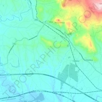
Name: Arce topographic map, elevation, terrain.

Location: Arce, Frosinone, Lazio, 03032, Italy (41.52040 13.50683 41.60597 13.59831)

Average elevation: 195 m

Minimum elevation: 74 m

Maximum elevation: 764 m

Gear up for your next adventure:

⛺Backpacking Tent - Lightweight tent for long-distance hiking trips
🧭GPS Outdoor Watch - Smart watch for navigation and fitness tracking in nature
🥽Outdoor Goggles - Protective eyewear for outdoor activities
🧥Thermal Fleece Jacket - Versatile insulation for changing mountain temperatures
❄️Traction Ice Cleats - Slip-on spikes for icy trails and winter hiking

As an Amazon Associate, this site earns from qualifying purchases at no extra cost to you.