
Thank you for supporting this site ❤️
Make a donation
Make a donation
Gear up for your next adventure:
As an Amazon Associate, this site earns from qualifying purchases at no extra cost to you.
Tregaron topographic map
Click on the map to display elevation.
Thank you for supporting this site ❤️
Make a donation
Make a donation
Gear up for your next adventure:
As an Amazon Associate, this site earns from qualifying purchases at no extra cost to you.
About this map
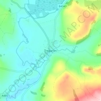
Name: Tregaron topographic map, elevation, terrain.
Location: Tregaron, Ceredigion, Wales, SY25 6HH, United Kingdom (52.18003 -3.97428 52.26003 -3.89428)
Average elevation: 245 m
Minimum elevation: 132 m
Maximum elevation: 497 m
Thank you for supporting this site ❤️
Make a donation
Make a donation
Gear up for your next adventure:
As an Amazon Associate, this site earns from qualifying purchases at no extra cost to you.