Geolocate

Sesma topographic map

Click on the map to display elevation.

About this map

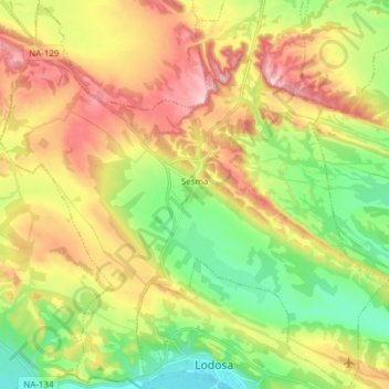
Name: Sesma topographic map, elevation, terrain.

Location: Sesma, Estellerria / Tierra Estella, Navarre, 31293, Spain (42.41762 -2.16216 42.52869 -2.01008)

Average elevation: 418 m

Minimum elevation: 313 m

Maximum elevation: 551 m

Gear up for your next adventure:

🧦Outdoor Socks - Durable socks designed for hiking and outdoor sports
🥾Waterproof Trail Shoes - Shoes designed to handle wet terrain
🧶550 Survival Paracord - Versatile utility cord for emergency repairs and rigging
🥾Trekking Poles - Adjustable trekking poles to reduce knee stress and improve stability
🧢Beanie Hat - Keep your head warm in cold weather

As an Amazon Associate, this site earns from qualifying purchases at no extra cost to you.