Geolocate

Briançon topographic map

Click on the map to display elevation.

Briançon

Due to its elevation, Briançon features a warm-summer humid continental climate (Köppen : Dfb), bordering on an oceanic climate (Cfb) under the Köppen system. Summers are warm with cool nights, and winters are cold and snowy.

About this map
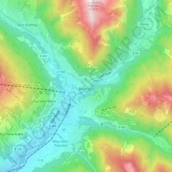
Name: Briançon topographic map, elevation, terrain.

Location: Briançon, Hautes-Alpes, Provence-Alpes-Côte d'Azur, Metropolitan France, 05100, France (44.86922 6.60043 44.92979 6.70650)

Average elevation: 1,614 m

Minimum elevation: 1,160 m

Maximum elevation: 2,597 m

Gear up for your next adventure:

🪜Heavy Duty Carabiners - Multi-use clips for securing gear to your backpack
🛰️Satellite Messenger - Emergency communication for areas with no cell service
🧶550 Survival Paracord - Versatile utility cord for emergency repairs and rigging
🥾Light Hiking Boots - Lightweight and comfortable boots for day hikes
⛺Lightweight Camping Tent - Portable shelter optimized for Canadian backcountry camping

As an Amazon Associate, this site earns from qualifying purchases at no extra cost to you.