
Thank you for supporting this site ❤️
Make a donation
Make a donation
Gear up for your next adventure:
As an Amazon Associate, this site earns from qualifying purchases at no extra cost to you.
Lendiguda topographic map
Click on the map to display elevation.
Thank you for supporting this site ❤️
Make a donation
Make a donation
Gear up for your next adventure:
As an Amazon Associate, this site earns from qualifying purchases at no extra cost to you.
About this map
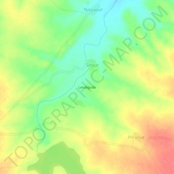
Name: Lendiguda topographic map, elevation, terrain.
Location: Lendiguda, Sirpur, Kinwat, Nanded District, Maharashtra, India (19.79463 78.28970 19.83463 78.32970)
Average elevation: 286 m
Minimum elevation: 258 m
Maximum elevation: 313 m
Thank you for supporting this site ❤️
Make a donation
Make a donation
Gear up for your next adventure:
As an Amazon Associate, this site earns from qualifying purchases at no extra cost to you.