
Neriga topographic map
Click on the map to display elevation.
About this map
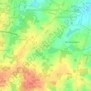
Name: Neriga topographic map, elevation, terrain.
Location: Neriga, Anekal, Bengaluru Urban, Karnataka, 560087, India (12.89177 77.75653 12.93177 77.79653)
Average elevation: 885 m
Minimum elevation: 860 m
Maximum elevation: 906 m
Other topographic maps
Click on a map to view its topography, its elevation and its terrain.