Geolocate

Tyro topographic map

Click on the map to display elevation.

About this map

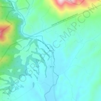
Name: Tyro topographic map, elevation, terrain.

Location: Tyro, Nelson County, Virginia, 22976, United States (37.80153 -79.02475 37.84153 -78.98475)

Average elevation: 322 m

Minimum elevation: 227 m

Maximum elevation: 707 m

Gear up for your next adventure:

🧦Crew Hiking Socks - Comfortable socks for long-distance hikes
🧥Fleece Jacket - Warm and lightweight jacket for layering
🥾Lightweight Hiking Boots - Boots for comfort and mobility on long hikes
🧳Compression Sacks - Maximize space in your backpack by shrinking gear
🍽️Titanium Camping Spork - Ultralight and indestructible eating utensil

As an Amazon Associate, this site earns from qualifying purchases at no extra cost to you.