Geolocate

Bhagalpur topographic map

Click on the map to display elevation.

About this map

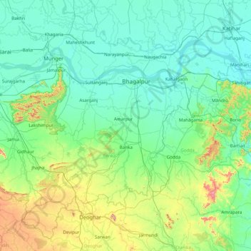
Name: Bhagalpur topographic map, elevation, terrain.

Location: Bhagalpur, Banka, Bihar, 813103, India (24.30000 86.21667 25.70000 87.61667)

Average elevation: 117 m

Minimum elevation: 22 m

Maximum elevation: 715 m

Gear up for your next adventure:

🧭GPS Handheld Device - Reliable GPS navigation for outdoor adventures
🧊Insulated Water Bottle - Keeps drinks cold in summer and prevents freezing in winter
🔦LED Headtorch - Bright and durable light for night activities
🏃Hydration Running Vest - Carry water and maps close to your body for speed
🦌Outdoor Trail Camera - Monitor wildlife activity near your favorite spots

As an Amazon Associate, this site earns from qualifying purchases at no extra cost to you.