Geolocate

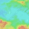
Kozhinjampara topographic map

Click on the map to display elevation.

About this map
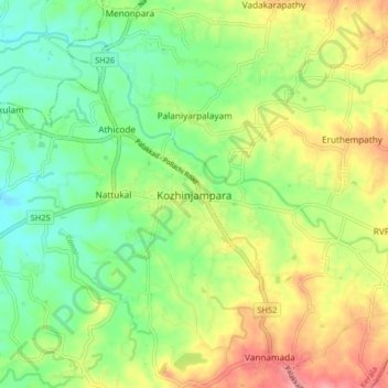
Name: Kozhinjampara topographic map, elevation, terrain.

Location: Kozhinjampara, Chittur, Palakkad, Kerala, 678555, India (10.69843 76.79387 10.77843 76.87387)

Average elevation: 156 m

Minimum elevation: 117 m

Maximum elevation: 209 m

Other topographic maps

Click on a map to view its topography, its elevation and its terrain.
Parambikulam

India > Kerala > Chittur

Average elevation: 696 m

Meenkara Dam

India > Kerala > Chittur > Govindapuram

Average elevation: 155 m

Chittur-Thathamangalam

India > Kerala > Chittur > Manchira

Average elevation: 117 m

Kaikatty

India > Kerala > Chittur

Average elevation: 929 m

Gear up for your next adventure:

🧦Merino Wool Socks - Moisture-wicking comfort for long-distance hiking
🛶Kayak Accessories - Essential gear for safe and fun kayaking adventures
🥾Trekking Boots - Durable boots for long-distance trekking
💡Compact LED Flashlight - Powerful and portable flashlight for outdoor use
🥾Mountain Hiking Boots - High-traction boots for rocky terrain

As an Amazon Associate, this site earns from qualifying purchases at no extra cost to you.