Geolocate

La Noria topographic map

Click on the map to display elevation.

About this map

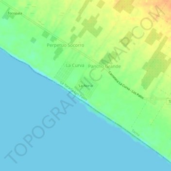
Name: La Noria topographic map, elevation, terrain.

Location: La Noria, La Curva, La Yarada-Los Palos, Tacna, Perú (-18.28236 -70.51351 -18.24236 -70.47351)

Average elevation: 11 m

Minimum elevation: 0 m

Maximum elevation: 33 m

Gear up for your next adventure:

💧Collapsible Water Bottle - Space-saving water bottle for outdoor activities
🧥Waterproof Pants - Keep dry during rainy hiking conditions
🥽Outdoor Goggles - Protective eyewear for outdoor activities
Lightweight Camping Tent - Portable shelter optimized for Canadian backcountry camping
🔋Solar Power Bank - Keep your GPS and devices charged during long outdoor trips

As an Amazon Associate, this site earns from qualifying purchases at no extra cost to you.