
Greve Strand topographic map
Interactive map
Click on the map to display elevation.
About this map
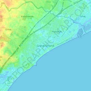
Name: Greve Strand topographic map, elevation, terrain.
Location: Greve Strand, Greve Kommune, 2670, Danimarca (55.54337 12.25993 55.62337 12.33993)
Average elevation: 5 m
Minimum elevation: -3 m
Maximum elevation: 27 m