
Thank you for supporting this site ❤️
Make a donation
Make a donation
Gear up for your next adventure:
As an Amazon Associate, this site earns from qualifying purchases at no extra cost to you.
Cocachacra topographic map
Click on the map to display elevation.
Thank you for supporting this site ❤️
Make a donation
Make a donation
Gear up for your next adventure:
As an Amazon Associate, this site earns from qualifying purchases at no extra cost to you.
About this map
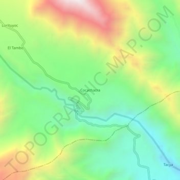
Name: Cocachacra topographic map, elevation, terrain.
Location: Cocachacra, Iray, Provincia de Condesuyos, Arequipa, Perú (-15.93137 -72.56735 -15.89137 -72.52735)
Average elevation: 1,653 m
Minimum elevation: 1,157 m
Maximum elevation: 2,466 m
Thank you for supporting this site ❤️
Make a donation
Make a donation
Gear up for your next adventure:
As an Amazon Associate, this site earns from qualifying purchases at no extra cost to you.