Ilmenau topographic map
Click on the map to display elevation.
Ilmenau
Ilmenau (German pronunciation: [ˈɪlmənaʊ] ) is a town in Thuringia, central Germany. It is the largest town within the Ilm district with a population of 38,600, while the district capital is Arnstadt. Ilmenau is located approximately 33 km (21 miles) south of Erfurt and 135 km (84 miles) north of Nuremberg within the Ilm valley at the northern edge of the Thuringian Forest at an elevation of 500 metres (1,640 feet).
About this map
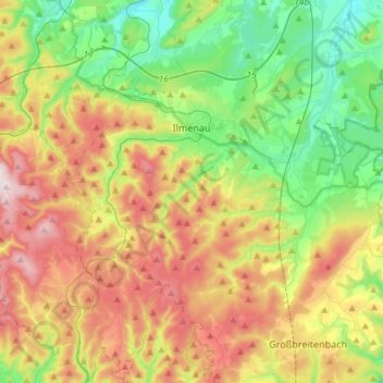
Name: Ilmenau topographic map, elevation, terrain.
Location: Ilmenau, Ilm-Kreis, Thuringia, Germany (50.56143 10.81823 50.74946 11.06661)
Average elevation: 604 m
Minimum elevation: 364 m
Maximum elevation: 965 m
Other topographic maps
Click on a map to view its topography, its elevation and its terrain.