
Thank you for supporting this site ❤️
Make a donation
Make a donation
Gear up for your next adventure:
As an Amazon Associate, this site earns from qualifying purchases at no extra cost to you.
Jose P. Laurel topographic map
Click on the map to display elevation.
Thank you for supporting this site ❤️
Make a donation
Make a donation
Gear up for your next adventure:
As an Amazon Associate, this site earns from qualifying purchases at no extra cost to you.
About this map
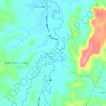
Name: Jose P. Laurel topographic map, elevation, terrain.
Location: Jose P. Laurel, Northern Samar, Eastern Visayas, Philippines (12.44912 124.52480 12.48912 124.56480)
Average elevation: 27 m
Minimum elevation: 1 m
Maximum elevation: 111 m
Thank you for supporting this site ❤️
Make a donation
Make a donation
Gear up for your next adventure:
As an Amazon Associate, this site earns from qualifying purchases at no extra cost to you.