Geolocate

Ciakar topographic map

Click on the map to display elevation.

About this map

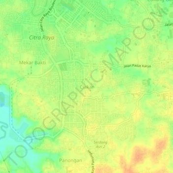
Name: Ciakar topographic map, elevation, terrain.

Location: Ciakar, Tangerang Regency, Banten, 15710, Indonesia (-6.28567 106.51092 -6.24567 106.55092)

Average elevation: 35 m

Minimum elevation: 15 m

Maximum elevation: 49 m

Gear up for your next adventure:

🥾Hiking Shoes - Durable and comfortable shoes for trail hiking
Camping Essentials - All-in-one gear for a comfortable camping trip
🥾Approach Shoes - Shoes designed for climbing approaches and rugged trails
🔭Compact Binoculars - Lightweight optics for scouting trails and wildlife
🏕️Camping Hammock - Integrated protection for sleeping between trees

As an Amazon Associate, this site earns from qualifying purchases at no extra cost to you.