Geolocate

Salihli topographic map

Click on the map to display elevation.

About this map

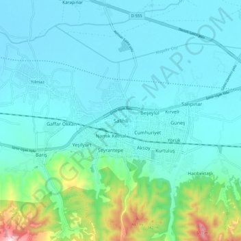
Name: Salihli topographic map, elevation, terrain.

Location: Salihli, Adala, Salihli, Manisa, Aegean Region, 45325, Turkey (38.44606 28.09900 38.52606 28.17900)

Average elevation: 157 m

Minimum elevation: 78 m

Maximum elevation: 580 m

Gear up for your next adventure:

🧭GPS Outdoor Watch - Smart watch for navigation and fitness tracking in nature
💡Portable Camping Lamp - Rechargeable lamp for campsite lighting
🧴First Aid Kit - Essential first aid supplies for outdoor emergencies
🚲Handlebar Phone Mount - View topographic-map.com live while cycling
🧰Multitool Knife - Compact and versatile tool for outdoor use

As an Amazon Associate, this site earns from qualifying purchases at no extra cost to you.