
Thank you for supporting this site ❤️
Make a donation
Make a donation
Gear up for your next adventure:
As an Amazon Associate, this site earns from qualifying purchases at no extra cost to you.
Hualla topographic map
Click on the map to display elevation.
Thank you for supporting this site ❤️
Make a donation
Make a donation
Gear up for your next adventure:
As an Amazon Associate, this site earns from qualifying purchases at no extra cost to you.
About this map
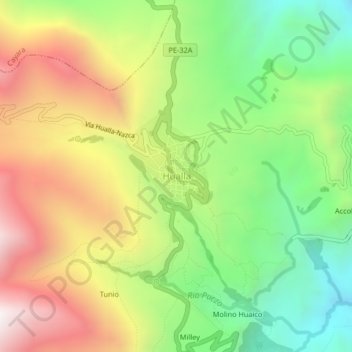
Name: Hualla topographic map, elevation, terrain.
Location: Hualla, Huaya, Provincia de Víctor Fajardo, Ayacucho, Perú (-13.86984 -73.97087 -13.82984 -73.93087)
Average elevation: 3,396 m
Minimum elevation: 2,801 m
Maximum elevation: 4,124 m
Thank you for supporting this site ❤️
Make a donation
Make a donation
Gear up for your next adventure:
As an Amazon Associate, this site earns from qualifying purchases at no extra cost to you.