Geolocate

Olivella topographic map

Click on the map to display elevation.

About this map

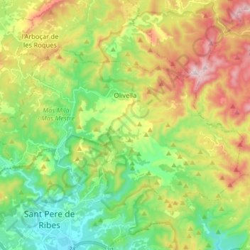
Name: Olivella topographic map, elevation, terrain.

Location: Olivella, Garraf, Barcelona, Catalonia, 08818, Spain (41.26815 1.74328 41.32922 1.87289)

Average elevation: 221 m

Minimum elevation: 24 m

Maximum elevation: 534 m

Other topographic maps

Click on a map to view its topography, its elevation and its terrain.

Gear up for your next adventure:

🧥Thermal Layer - Insulating layer for cold outdoor conditions
🎒Backpack Rain Cover - External shield to keep your entire pack dry
🧴Waterproofing Spray - Restore the DWR coating on jackets and tents
🔨Vehicle Emergency Tool - Safety tool for remote road trips to trailheads
🥾Mountain Hiking Shoes - Shoes with superior grip for mountainous terrain

As an Amazon Associate, this site earns from qualifying purchases at no extra cost to you.