
Thank you for supporting this site ❤️
Make a donation
Make a donation
Gear up for your next adventure:
As an Amazon Associate, this site earns from qualifying purchases at no extra cost to you.
Pojo topographic map
Click on the map to display elevation.
Thank you for supporting this site ❤️
Make a donation
Make a donation
Gear up for your next adventure:
As an Amazon Associate, this site earns from qualifying purchases at no extra cost to you.
About this map
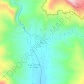
Name: Pojo topographic map, elevation, terrain.
Location: Pojo, Municipio Pojo, Carrasco, Cochabamba, Bolivia (-17.77716 -64.88298 -17.73716 -64.84298)
Average elevation: 2,141 m
Minimum elevation: 1,921 m
Maximum elevation: 2,671 m
Thank you for supporting this site ❤️
Make a donation
Make a donation
Gear up for your next adventure:
As an Amazon Associate, this site earns from qualifying purchases at no extra cost to you.