
Salavaux topographic map
Interactive map
Click on the map to display elevation.
About this map
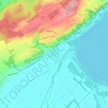
Name: Salavaux topographic map, elevation, terrain.
Average elevation: 473 m
Minimum elevation: 422 m
Maximum elevation: 591 m
Other topographic maps
Click on a map to view its topography, its elevation and its terrain.
Montmagny
Suisse > Vaud > District de la Broye-Vully > Vully-les-Lacs > Montmagny
Average elevation: 489 m