Geolocate

Lapogan topographic map

Click on the map to display elevation.

About this map

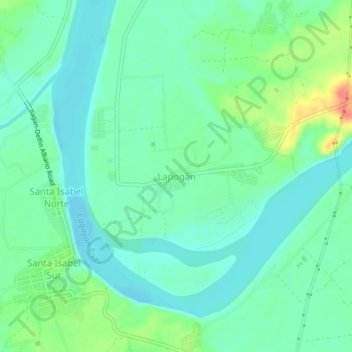
Name: Lapogan topographic map, elevation, terrain.

Location: Lapogan, Tumauini, Isabela, Cagayan Valley, Philippines (17.18579 121.81603 17.22579 121.85603)

Average elevation: 38 m

Minimum elevation: 21 m

Maximum elevation: 83 m

Gear up for your next adventure:

🧴Bear Spray Holster - Quick-access carry for essential Canadian wilderness safety
Tent Footprint - Protect tent floor and increase durability
🚲Bike Repair Kit - Essential tools for on-trail mechanical issues
🐕Hiking Dog Pack - Let your canine companion carry their own water and food
🔪Outdoor Multitool - Versatile tool for repairs and food prep in the wild

As an Amazon Associate, this site earns from qualifying purchases at no extra cost to you.