Geolocate

Ipiñuma topographic map

Click on the map to display elevation.

About this map

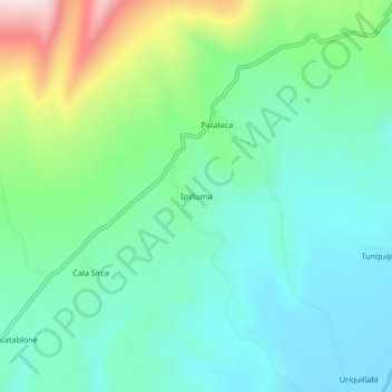
Name: Ipiñuma topographic map, elevation, terrain.

Location: Ipiñuma, Pisacoma, Chucuito, Puno, Perú (-17.12956 -69.54987 -17.08956 -69.50987)

Average elevation: 4,320 m

Minimum elevation: 4,207 m

Maximum elevation: 4,637 m

Gear up for your next adventure:

🥾Approach Boots - Comfortable boots for hiking and climbing approaches
🧭GPS Tracker - Track your location in remote areas safely
🔦LED Headlamp - Hands-free lighting for early morning starts or late finishes
👟Trail Running Shoes - Agile footwear for fast-paced topographic exploration
Backpacking Tent - Lightweight tent for long-distance hiking trips

As an Amazon Associate, this site earns from qualifying purchases at no extra cost to you.