Geolocate

Cisnes topographic map

Click on the map to display elevation.

About this map

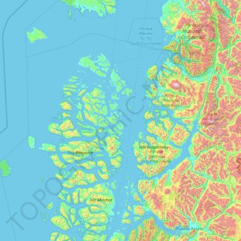
Name: Cisnes topographic map, elevation, terrain.

Location: Cisnes, Provincia de Aysén, Aysén Region, 6010000, Chile (-45.16139 -75.20374 -43.63854 -72.05056)

Average elevation: 275 m

Minimum elevation: -3 m

Maximum elevation: 2,323 m

Other topographic maps

Click on a map to view its topography, its elevation and its terrain.

La Junta

Chile > Aysén Region > Provincia de Aysén > Cisnes

Average elevation: 146 m

Gear up for your next adventure:

🧶550 Survival Paracord - Versatile utility cord for emergency repairs and rigging
🛶Kayak Accessories - Essential gear for safe and fun kayaking adventures
🎒Fully Waterproof Backpack - Total protection for photography gear and electronics
🥤Collapsible Travel Cup - Saves space and weight in your mess kit
🥾Approach Shoes - Shoes designed for climbing approaches and rugged trails

As an Amazon Associate, this site earns from qualifying purchases at no extra cost to you.