
Ammerbuch topographic map
Click on the map to display elevation.
About this map
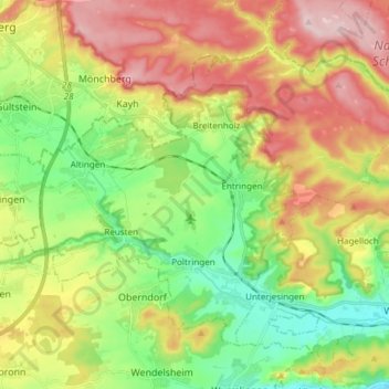
Name: Ammerbuch topographic map, elevation, terrain.
Location: Ammerbuch, Landkreis Tübingen, Baden-Württemberg, 72119, Germany (48.51394 8.88376 48.59132 9.03419)
Average elevation: 438 m
Minimum elevation: 326 m
Maximum elevation: 583 m
Other topographic maps
Click on a map to view its topography, its elevation and its terrain.