Geolocate

Chilla topographic map

Click on the map to display elevation.

About this map

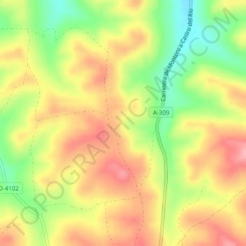
Name: Chilla topographic map, elevation, terrain.

Location: Chilla, Bujalance, Córdoba, Andalucía, 14659, España (37.91127 -4.39404 37.93127 -4.37404)

Average elevation: 289 m

Minimum elevation: 223 m

Maximum elevation: 343 m

Gear up for your next adventure:

🔭Compact Binoculars - Lightweight optics for scouting trails and wildlife
🧭GPS Handheld Device - Reliable GPS navigation for outdoor adventures
🧶550 Survival Paracord - Versatile utility cord for emergency repairs and rigging
🥘Camping Cookware Set - Compact nesting pots and pans for trail cooking
🥾Light Trekking Boots - Supportive boots for multi-day treks

As an Amazon Associate, this site earns from qualifying purchases at no extra cost to you.