Geolocate

St-Sulpice NE topographic map

Click on the map to display elevation.

About this map

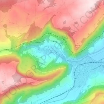
Name: St-Sulpice NE topographic map, elevation, terrain.

Location: St-Sulpice NE, Val-de-Travers, Neuchâtel, 2123, Suisse (46.88949 6.54392 46.92949 6.58392)

Average elevation: 960 m

Minimum elevation: 737 m

Maximum elevation: 1,193 m

Gear up for your next adventure:

Camping Coffee Maker - Brew fresh coffee anywhere on the topographic map
Camping Tent - Weather-resistant tents suitable for 2 to 6 people
🚲MTB Frame Bag - Carry tools and maps directly on your bicycle frame
🎒Backpack Rain Cover - External shield to keep your entire pack dry
🥾Mountain Hiking Shoes - Shoes with superior grip for mountainous terrain

As an Amazon Associate, this site earns from qualifying purchases at no extra cost to you.