
Hoton topographic map
Interactive map
Click on the map to display elevation.
About this map
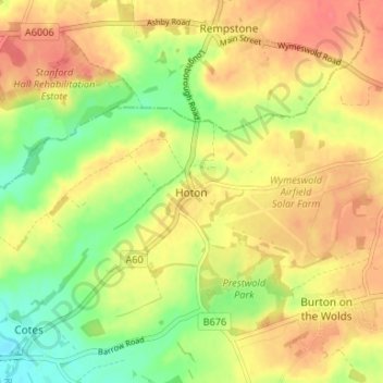
Name: Hoton topographic map, elevation, terrain.
Location: Hoton, Charnwood, Leicestershire, Angleterre, Royaume-Uni (52.78870 -1.18283 52.80650 -1.11670)
Average elevation: 69 m
Minimum elevation: 37 m
Maximum elevation: 93 m