Geolocate

Kalawaan topographic map

Click on the map to display elevation.

About this map

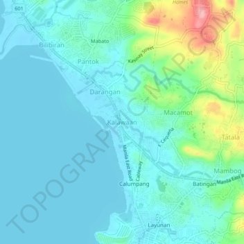
Name: Kalawaan topographic map, elevation, terrain.

Location: Kalawaan, Binangonan, Rizal, Calabarzon, 1903, Philippines (14.46526 121.16711 14.50526 121.20711)

Average elevation: 26 m

Minimum elevation: 0 m

Maximum elevation: 135 m

Gear up for your next adventure:

🗺️Topographic Maps - Detailed maps to explore trails, mountains, and wilderness areas
🥾Trail Hiking Boots - Supportive boots for rough trails
🕯️Camping Lantern - Illuminates your entire campsite with high-efficiency LEDs
🕶️Polarized Sunglasses - Reduces glare from snow and water at high elevations
🧥Packable Rain Jacket - Breathable waterproof layer for unpredictable weather

As an Amazon Associate, this site earns from qualifying purchases at no extra cost to you.