Geolocate

Pandaloor topographic map

Click on the map to display elevation.

About this map

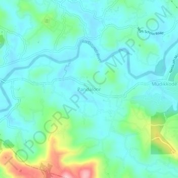
Name: Pandaloor topographic map, elevation, terrain.

Location: Pandaloor, Ernad, Malappuram District, Kerala, 676122, India (11.06527 76.14510 11.10527 76.18510)

Average elevation: 59 m

Minimum elevation: 17 m

Maximum elevation: 209 m

Other topographic maps

Click on a map to view its topography, its elevation and its terrain.

Manjeri

India > Kerala > Ernad

Manjeri is located at 11°07′N 76°07′E / 11.12°N 76.12°E / 11.12; 76.12. It has an average elevation of 38 metres (124 feet) from sea level.

Average elevation: 58 m

Alathurpadi

India > Kerala > Ernad > Malappuram

Average elevation: 64 m

Vandoor

India > Kerala > Ernad

Average elevation: 59 m

Irumbuzhi

India > Kerala > Ernad > Malappuram

Average elevation: 43 m

Areekkode

India > Kerala > Ernad

Average elevation: 112 m

Malappuram

India > Kerala > Ernad

Average elevation: 56 m

Malappuram

India > Kerala > Ernad > Malappuram

Average elevation: 62 m

Kavanur

India > Kerala > Ernad > Kavanoor

Average elevation: 42 m

Manjeri

India > Kerala > Ernad

Manjeri is located at 11°07′N 76°07′E / 11.12°N 76.12°E / 11.12; 76.12. It has an average elevation of 38 metres (124 feet) from sea level.

Average elevation: 58 m

Gear up for your next adventure:

🏕️Camping Hammock - Integrated protection for sleeping between trees
🛶Canoe Life Vest - Safety vest for water sports
🧢Outdoor Cap - Protective cap for sun and rain during hikes
🧢Hiking Sun Hat - Wide-brimmed protection for exposed mountain ridges
🥾Approach Boots - Comfortable boots for hiking and climbing approaches

As an Amazon Associate, this site earns from qualifying purchases at no extra cost to you.