
Kampung Parit Haji Hassan topographic map
Interactive map
Click on the map to display elevation.
About this map
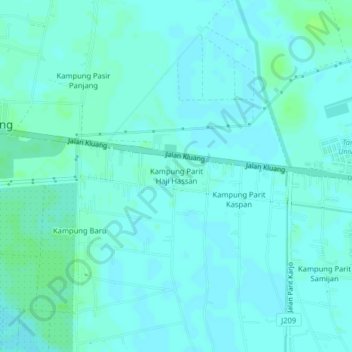
Name: Kampung Parit Haji Hassan topographic map, elevation, terrain.
Average elevation: 4 m
Minimum elevation: 1 m
Maximum elevation: 9 m
Other topographic maps
Click on a map to view its topography, its elevation and its terrain.
Kampung Pasir Panjang
Malaysia > Johor > Sri Gading > Kampung Pasir Panjang
Kampung Pasir Panjang, Sri Gading, Batu Pahat, Johor, 83300, Malaysia
Average elevation: 4 m