
新昌乡 topographic map
Interactive map
Click on the map to display elevation.
About this map
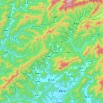
Name: 新昌乡 topographic map, elevation, terrain.
Location: 新昌乡, 常山县, 衢州市, 浙江省, 中国 (29.03259 118.51454 29.20404 118.67616)
Average elevation: 408 m
Minimum elevation: 104 m
Maximum elevation: 1,210 m
Other topographic maps
Click on a map to view its topography, its elevation and its terrain.