Geolocate

Jennersdorf topographic map

Click on the map to display elevation.

About this map
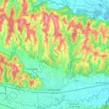
Name: Jennersdorf topographic map, elevation, terrain.

Location: Jennersdorf, Bezirk Jennersdorf, Burgenland, 8380, Austria (46.92477 16.09378 46.99485 16.18715)

Average elevation: 280 m

Minimum elevation: 225 m

Maximum elevation: 378 m

Gear up for your next adventure:

💡LED Camping Lantern - Illuminate your campsite with long-lasting lanterns
🧥Insulated Jacket - Keep warm in cold outdoor conditions
🪑Insulated Seat Pad - Protect your seat from cold rocks and wet logs
⛺Camping Essentials - All-in-one gear for a comfortable camping trip
🛌Insulated Sleeping Pad - Critical thermal barrier between you and the cold ground

As an Amazon Associate, this site earns from qualifying purchases at no extra cost to you.