Geolocate

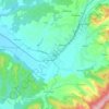
Rajsavac topographic map

Click on the map to display elevation.

About this map

Name: Rajsavac topographic map, elevation, terrain.

Location: Rajsavac, Općina Jakšić, Požega-Slavonia County, Croatia (45.34202 17.78577 45.38193 17.81551)

Average elevation: 167 m

Minimum elevation: 132 m

Maximum elevation: 187 m

Other topographic maps

Click on a map to view its topography, its elevation and its terrain.

Lipik

Croatia > Požega-Slavonia County

Average elevation: 197 m

Mihaljevići

Croatia > Požega-Slavonia County > Brđani

Average elevation: 193 m

Paka

Croatia > Požega-Slavonia County

Average elevation: 261 m

Gear up for your next adventure:

🧴Outdoor Sunscreen - High SPF protection for high-altitude UV exposure
⛺Bushcraft Tarp - Versatile emergency shelter or gear protection
🎒Backpack Rain Cover - External shield to keep your entire pack dry
🥾Mountaineering Boots - Supportive boots for climbing and high-altitude hiking
🥾Approach Boots - Comfortable boots for hiking and climbing approaches

As an Amazon Associate, this site earns from qualifying purchases at no extra cost to you.