Geolocate

Santa Catalina topographic map

Click on the map to display elevation.

About this map
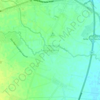
Name: Santa Catalina topographic map, elevation, terrain.

Location: Santa Catalina, Tarlac City, Tarlac, Central Luzon, 2301, Philippines (15.45042 120.63982 15.49042 120.67982)

Average elevation: 32 m

Minimum elevation: 24 m

Maximum elevation: 40 m

Other topographic maps

Click on a map to view its topography, its elevation and its terrain.
Maria Cristina Park

Philippines > Tarlac > Tarlac City

Average elevation: 48 m

San Rafael Creek

Philippines > Tarlac > Tarlac City

Average elevation: 41 m

San Rafael Creek

Philippines > Tarlac > Tarlac City > San Jose

Average elevation: 41 m

Gear up for your next adventure:

🧦Merino Wool Socks - Moisture-wicking comfort for long-distance hiking
🥾Waterproof Trail Shoes - Shoes designed to handle wet terrain
🥤Collapsible Travel Cup - Saves space and weight in your mess kit
🧢Hiking Hat - Sun-protective and breathable hats for long treks
🦶Hiking Shoe Insoles - Added support for high arches and long days on feet

As an Amazon Associate, this site earns from qualifying purchases at no extra cost to you.