Geolocate

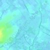
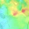
Laires topographic map

Click on the map to display elevation.

About this map

Name: Laires topographic map, elevation, terrain.

Location: Laires, Saint-Omer, Pas-de-Calais, Hauts-de-France, Metropolitan France, 62960, France (50.51834 2.23134 50.56341 2.28584)

Average elevation: 163 m

Minimum elevation: 80 m

Maximum elevation: 194 m

Other topographic maps

Click on a map to view its topography, its elevation and its terrain.

Panehem

France > Hauts-de-France > Pas-de-Calais > Samer

Average elevation: 70 m

Le Petit Vimy

France > Hauts-de-France > Pas-de-Calais > Vimy

Average elevation: 93 m

Noyelles

France > Hauts-de-France > Pas-de-Calais > Bours

Average elevation: 125 m

Gear up for your next adventure:

🔦LED Flashlight - Powerful and long-lasting flashlight for camping and emergencies
🛁Quick-Dry Microfiber Towel - Space-saving towel that dries rapidly on the move
🥾Mountain Hiking Boots - High-traction boots for rocky terrain
🧰Survival Kit - Essential gear for emergencies in the wilderness
🥾Mountain Hiking Shoes - Shoes with superior grip for mountainous terrain

As an Amazon Associate, this site earns from qualifying purchases at no extra cost to you.