Geolocate

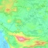
La Calera topographic map

Click on the map to display elevation.

About this map

Name: La Calera topographic map, elevation, terrain.

Location: La Calera, Tlajomulco de Zúñiga, Región Centro, Jalisco, 45678, Mexico (20.43051 -103.27336 20.47051 -103.23336)

Average elevation: 1,552 m

Minimum elevation: 1,512 m

Maximum elevation: 1,770 m

Other topographic maps

Click on a map to view its topography, its elevation and its terrain.
Gear up for your next adventure:

🥾Waterproof Hiking Boots - Essential footwear for rugged terrain and wet Canadian trails
🥤Collapsible Travel Cup - Saves space and weight in your mess kit
🛶Kayak Dry Bag - Waterproof storage for kayaking adventures
🛁Quick-Dry Microfiber Towel - Space-saving towel that dries rapidly on the move
🔭Outdoor Binoculars - Lightweight binoculars for birdwatching and hiking

As an Amazon Associate, this site earns from qualifying purchases at no extra cost to you.