Geolocate

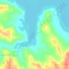
Jordan topographic map

Click on the map to display elevation.

About this map

Name: Jordan topographic map, elevation, terrain.

Location: Jordan, Garfield County, Montana, 59337, United States (47.31511 -106.91665 47.32648 -106.90323)

Average elevation: 804 m

Minimum elevation: 785 m

Maximum elevation: 837 m

Other topographic maps

Click on a map to view its topography, its elevation and its terrain.

Geyser Spring

United States > Montana > Garfield County

Average elevation: 936 m

Gear up for your next adventure:

🥾Light Hiking Boots - Lightweight and comfortable boots for day hikes
💧Hydration Bladder - Hands-free hydration solution for long treks
💡Compact LED Flashlight - Powerful and portable flashlight for outdoor use
🧭Orienteering Kit - Tools for map reading and navigation in the wild
🕯️Camping Lantern - Illuminates your entire campsite with high-efficiency LEDs

As an Amazon Associate, this site earns from qualifying purchases at no extra cost to you.