Geolocate

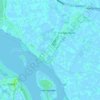
Vlissingen topographic map

Click on the map to display elevation.

Vlissingen

Topographic map of Vlissingen (city), Sept. 2014

Wikipedia (CC-BY-SA 3.0)

About this map

Name: Vlissingen topographic map, elevation, terrain.

Location: Vlissingen, Zeeland, Netherlands (51.37297 3.30794 51.61641 3.73804)

Average elevation: 0 m

Minimum elevation: -5 m

Maximum elevation: 34 m

Other topographic maps

Click on a map to view its topography, its elevation and its terrain.
Monnikendijk

Netherlands > Zeeland > Kattendijke

Average elevation: -2 m

Rancho Grande

Netherlands > Zeeland > Kamperland

Average elevation: 1 m

Braamhul

Netherlands > Zeeland > Eede

Average elevation: 1 m

Pauluspolder

Netherlands > Zeeland > Hengstdijk

Average elevation: 0 m

Gear up for your next adventure:

🧦Hiking Socks - Moisture-wicking and comfortable socks for long hikes
🥘Camping Cookware Set - Compact nesting pots and pans for trail cooking
🐕Hiking Dog Pack - Let your canine companion carry their own water and food
🦟Insect Repellent - Keep mosquitoes and black flies away in wooded areas
🔥Camping Stove - Portable stoves to cook outdoors with ease

As an Amazon Associate, this site earns from qualifying purchases at no extra cost to you.