Geolocate

McCook topographic map

Click on the map to display elevation.

About this map

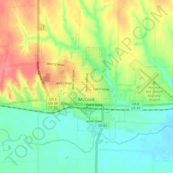
Name: McCook topographic map, elevation, terrain.

Location: McCook, Red Willow County, Nebraska, 69001, United States (40.18534 -100.66484 40.22569 -100.57789)

Average elevation: 777 m

Minimum elevation: 748 m

Maximum elevation: 820 m

Gear up for your next adventure:

🧢Hiking Hat - Sun-protective and breathable hats for long treks
🧶550 Survival Paracord - Versatile utility cord for emergency repairs and rigging
❄️Traction Ice Cleats - Slip-on spikes for icy trails and winter hiking
🧴First Aid Kit - Essential first aid supplies for outdoor emergencies
🌡️Emergency Mylar Blankets - Compact thermal protection for unexpected nights outdoors

As an Amazon Associate, this site earns from qualifying purchases at no extra cost to you.