Geolocate

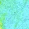
South Cembo topographic map

Click on the map to display elevation.

About this map

Name: South Cembo topographic map, elevation, terrain.

Location: South Cembo, Taguig District 2, Taguig, Southern Manila District, Metro Manila, 1645, Philippines (14.55603 121.04714 14.56215 121.05392)

Average elevation: 21 m

Minimum elevation: 4 m

Maximum elevation: 46 m

Other topographic maps

Click on a map to view its topography, its elevation and its terrain.
Taguig River

Philippines > Taguig

Average elevation: 6 m

Taguig River

Philippines > Taguig

Average elevation: 5 m

De Jesus Oval

Philippines > Taguig

Average elevation: 25 m

BGC Greenway Park

Philippines > Taguig

Average elevation: 25 m

Tipas River

Philippines > Taguig

Average elevation: 4 m

Taguig River

Philippines > Taguig

Average elevation: 3 m

Daang Manunuso Creek

Philippines > Taguig

Average elevation: 5 m

Gear up for your next adventure:

🧭GPS Handheld Device - Reliable GPS navigation for outdoor adventures
⛺Tent Footprint - Protect tent floor and increase durability
🐕Hiking Dog Pack - Let your canine companion carry their own water and food
🥫Freeze-Dried Meals - Lightweight, high-calorie nutrition for multi-day treks
🔥Emergency Fire Starter - Reliable ignition source for all weather conditions

As an Amazon Associate, this site earns from qualifying purchases at no extra cost to you.