Geolocate

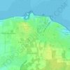
Ancien Fort topographic map

Click on the map to display elevation.

About this map

Name: Ancien Fort topographic map, elevation, terrain.

Location: Ancien Fort, Saint-Martin-de-Ré, La Rochelle, Charente-Maritime, Nouvelle-Aquitaine, France métropolitaine, 17410, France (46.18122 -1.37612 46.22122 -1.33612)

Average elevation: 5 m

Minimum elevation: -1 m

Maximum elevation: 16 m

Other topographic maps

Click on a map to view its topography, its elevation and its terrain.
Gear up for your next adventure:

💡Compact LED Flashlight - Powerful and portable flashlight for outdoor use
🚑Survival Whistle - Signal for help across long distances in mountains
🧢Outdoor Cap - Protective cap for sun and rain during hikes
🥾Waterproof Hiking Boots - Boots keeping your feet dry in wet conditions
🥾Hiking Leggings - Comfortable leggings for outdoor activities

As an Amazon Associate, this site earns from qualifying purchases at no extra cost to you.